The Merowe Dam Archaeological Salvage Project (MDASP)
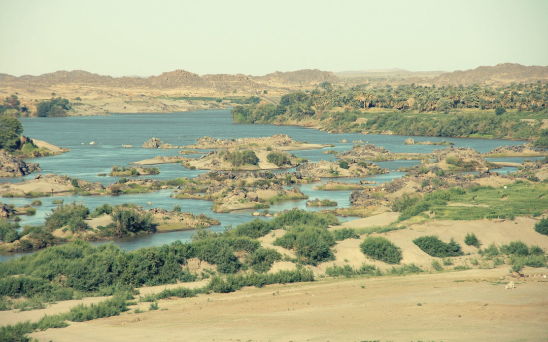
The idea of building a dam at the 4th Cataract of the Nile dates to the period of the Anglo-Egyptian administration in the Sudan (1943). After many studies made by expert international institutions and companies, the Government of Sudan decided to build a single dam across the island of Mirowy, located about 26 km upstream from the pyramids of Nuri. After its completion, the dam is situated on the river Nile, close to and inundating the 4th Cataract where the river divides into multiple smaller branches with large islands in between. The main purpose for building the dam was the generation of electricity. It has a length of about 9 kilometres and a crest height of up to 67 metres. It contains a reservoir of 12.5 cubic kilometres, or about 20% of the Nile’s annual flow; the reservoir level is 300 metres above sea level, with the Nile level downstream of the dam being about 265 metres. The reservoir lake extends 174 kilometres upstream.
As Salah Mohamed Ahmed (2003) puts it, „the aim of this [MDASP] project is to rescue archaeological sites endangered by the construction of Merowe Dam. The realisation of this dam will affect a considerable number of archaeological sites to varying degrees:
i) Sites which are going to be either destroyed by the engineering activities at the dam site or covered by the waters of the lake upstream. This will include a strip of land of about 170km on both banks of the Nile together with dozens of islands.
ii) Sites which are going to be destroyed by the building of houses and digging of irrigation canals in the resettlement areas.
iii) Sites which are going to be affected by the construction of the power transmission lines.
iv) Although the monumental sites of the Napata Region will not be directly affected by these activities, NCAM [National Corporation of Antiquities and Museums] is concerned with the expected environmental changes. These sites include the famous Pharaonic and Napato-Meroitic towns and cemeteries at Jebel Barkal, Nuri, Sanam, el-Kurru, Hillat el-Arab, the Post-Meroitic tumuli of ez-Zuma, the Christian monastery of Ghazali and the later strongholds at Merowe East, Kagabi, ed-Datti and possibly other sites located further downstream.”
The Hungarian Sudan Archaeological Project (HSAP)
Several institutions participated in the MDASP from different parts of the world. Among them, there was the Hungarian Sudan Archaeological Project, a self-funded organization of enthusiastic Hungarian archaeologists, egyptologists and arabists.
During January and February 2007, the HSAP arranged its second campaign in the 4th Cataract area of the Nile between the modern villages of el-Kir and Dar el-Arab. That year major political conflict occured between the Sudani government and the tribes living in the area to be inundated by the reserve. The grudge around compensation and relocation became ended a tribal decision to forcefully close areas to be surveyed. As a result, the Hungarian team lost its original concession area and the workplan for 2007. The NCAM offered to us a new strip of land, practically at the fringes of the former Napatan empire, approximately 40 kilometers form the famous archaeological site, Gebel Barkal.
This area previously was surveyed by the NCAM, but closer examinations were not conducted on most of the registered sites. Our hastly altered research plan has been targeted the richest occurences and some locations that we discovered during intensive field-walking in the first week of our campaign. We divided our team to three units, working on more locations against time.
Prehistory
As a result of our survey we discovered 21 prehistoric find-spots. In most of the cases they did not provide any characteristic artifact that we could recognize as cultural or temporal marker. Prehistoric occurrences concentrated in three sectors: at the main wadi site, designated as HSAP 072 near Hadj Razi, in the vicinity of the villages Umm Eterein and El Kir, and in an area of tightly packed jebels near Dar el-Arab village.
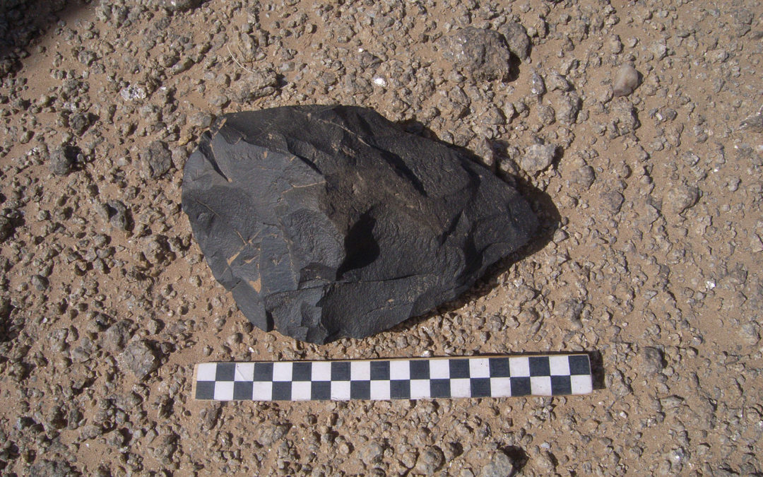
I excavated two disturbed Palaeolithic sites with characteristic „Nubian” cores, huge amount of flake debitage and very few formal tools. They occured as dense, mixed surface artifact concentrations at site HSAP 072. HSAP 072A situated on a small knoll in a huge wadi bed. Sondages made clear that this spot as well as other scatters in the bed were exclusively surface occurences. HSAP 072B again was a slightly mixed surface scatter along a small gully or khor, led into the main wadi. A 2 by 2 meter sondage here provided us a much better stratigraphy and subsurface material as well. The palaeolithic cultural remains at HSAP 072 represent intensive knapping events of many millennia. Local raw material sources, huge preforms, cores and innumerable amount of flakes testify almost every steps of lithic toolmaking. The artifacts are waiting for further study in Khartoum.
HSAP 057 presented a different situation and a different era, the beginning of the Mid-Holocene, at about 5500–5000 BC. The site was lying near the village Dar el-Arab, on a granite djebel’s plateau dissected by weathered boulders and cliffs, in the hill zone behind the habitation area. This surface site offered thousands of lithic artifacts and more than a hundred ceramic sherds to study. The plateau was inhabited by semi-sedentary groups of foragers, with a great view to the Nile. We encountered more such spots in the vicinity – this setting had to be desired at those times. They left carefully prepared microlithic tools behind, as well as ceramic vessels covered with exquisite „wavy line” decoration.
Kerma cemeteries
We investigated two Kerma period occurences, remains of a powerful Bronze Age kingdom centered around the Kerma Basin in the north. According to new field evidence, this culture had its influence along the 4th-5th cataract of the Nile, including our area of concession. This region is rich in burials covered with dry stone tumuli, standing lonely as well as in groups. The original mound shape of these monuments often reduced to humble stone rings, affected by erosion and looting.
We investigated a Middle Kerma period (2050–1750 BC) cemetery. Only two tumuli were undisturbed from the five we excavated on this hilltop. The graves were furnished with personal ornaments, food and drink offerings inside the appropriate containers. Huge amount of ceramic sherds were found in and around the superstructures – black topped polished vessels, characteristic of the Kerma culture. Besides, Egyptian imported containers testify far reaching contacts.
Late Meroitic and Post-Meroitic periods
We investigated two further extensive tumuli cemeteries from the late- (2–4 centuries AD) and post-Meroitic (3–6 centirues AD) ages. These monuments often reach a diameter of 20 meters with surprisingly well-endowed inhumations. Ceramic vessels, ostric eggs, delicate faience and glass jewelry waited for us beneath the mounds.
Christian era
Upper Nubia converted to the Christian faith by Egyptian and Byzantine missionaries at the turn of the 6¬7 centuries AD. Our concession area belonged to the Christian Kingdom of Makuria. Although the villages of those times are vanished, their cemeteries are not. We encountered rectangular dry stone superstructures (box-graves) almost everywhere, as well as innumerable rock carvings of crosses and other religious symbols.
Our most ambitious enterprise in the field was the excavation of a medieval town (6–14. centuries AD). Remains of different dry-stone buildings and dense artifact concentrations occupied approximately 100 ha, partly buried in sediments of an artificial inundation caused by the dam construction.
After a surface collection we have been investigated three locations within the settlement: a residential area with the remains of a house; a disturbed cemetery section, and ruins of a complex structure. The latter building had stone foundations, brick walls and numerous postholes carved in the bedrock. This area was covered with fineware and amphorae sherds, ostrich eggshell fragments, besides a sole Christian burial was found. Based on these phenomena it seems sure that the building functioned as the temple of the town.